
- Where
- Agadir, Souss-Massa
- Directions
- Directions
The Limestone Canyons of Ida-Ou-Tanane lie in the Western High Atlas, northeast of Agadir rather than south of it, in the district where the road climbs from the coastal plain into the mountains. The rock here is limestone, a pale, easily dissolved stone that water has cut into deep, narrow valleys, with cliffs, overhangs and rock pools carved over a very long time. The streams that run through them are fed by winter rain and by springs, and in spring they can be strong, while in summer many shrink to a trickle or disappear into the stones, leaving smooth, dry channels.
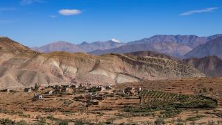
The scenery changes quickly as you climb. Near the coast, the land is dry and scrubby, with argan trees and rocky slopes. Moving inland, valleys narrow and the road winds past terraced fields of almond, fig and olive trees on stepped slopes held up by stone walls. Villages of earthen and stone houses cling to the hillsides, and Amazigh communities have farmed here for centuries, using irrigation channels to share water. The canyons are the dramatic part of this landscape, where cliffs of pale limestone rise above clear pools and green fringes of reeds and oleander.
The district is also known for its honey, and the route through the mountains is sometimes called the Honey Road, with stalls and cooperatives selling local honey, almonds and olive oil. Wild thyme and other mountain plants give the honey its character, and visitors can taste before buying. Stopping at a cooperative is a good way to support the local economy and to meet the people who keep bees, usually in simple hives placed along the slopes.
Hiking and photography are the main activities. Paths follow stream beds and village tracks, and in cooler months you can walk for a few hours between pools and viewpoints. While the walks are rewarding, the terrain can be rough and slippery, and flash floods are a danger after heavy rain, so avoid narrow canyon floors if the weather is unsettled. A local guide from Imouzzer or a nearby village can show the best routes and explain how the land is used. Visitors should wear shoes with grip, carry water and sun protection and tell someone where they are going.
Roads in the area are narrow and winding, with sharp bends and livestock, so drive carefully and allow extra time. Services are limited, so carry food and cash. Respect farmland and ask before photographing people or entering private land.
The canyons suit hikers, photographers and families who want a day away from the beaches of Agadir, and they combine well with the waterfalls of Imouzzer and the argan villages on the way. Spring is the best season, when the streams run and the hills are green.
Categories

More photos coming soon
Nearby Attractions
Other places to visit in Agadir
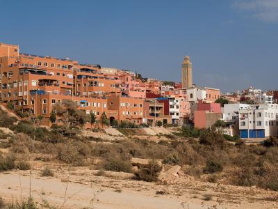
Tamraght Village
Relaxed Atlantic village with authentic culture and surf
Activities & Adventure · Coastal & Maritime

Kasbah of Agadir
16th-century fortress with panoramic city views
History & Heritage · Traditional Culture

Agadir Museum
Museum dedicated to the 1960 Agadir earthquake
Cultural Experiences · History & Heritage
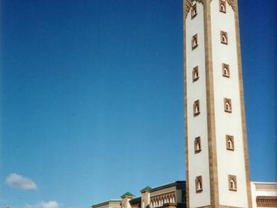
Mosque of Agadir
Largest mosque in Agadir, built in 1960
Architecture · Religious Sites
Questions people ask
Quick Facts
Best Time to Visit
All year for sun: January highs average about 21 °C and August about 27 °C. Most of the little rain falls from November to March; the sea is warmest (about 23 °C) in September and October.